Submitted to US Coast Guard NOTICE TO MARINERS
October 8, 2001
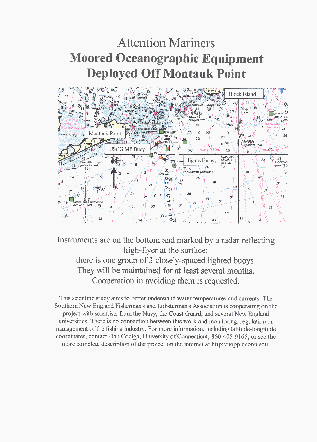
From October through December an array of oceanographic instruments is deployed offshore from Block Island Sound in the vicinity of Block Channel. The instruments measure currents, temperatures, salinities, and properties of the acoustic channel as part of a scientific research project.
All instruments except two lie in an area about 7 nm by 7 nm, within which the USCG Montauk Point buoy is toward the Northwest corner. Each instrument is moored on the bottom and marked at the surface by a radar-reflecting float. Separations between instruments are about 1.5-3 nm. Positions are:
LatN Deg Min LonW Deg Min
41-03.386? 71-45.246
41-01.662 71-45.649
41-01.816 71-40.537
41-00.718 71-43.905
40-59.831 71-47.388
40-58.310 71-42.652
Within the above region there is a group of three closely spaced lighted buoys at:
40-59.566 71-45.039
40-59.283 71-44.872
40-59.239 71-44.708.
About 15 nm West of the above region, one instrument is Southwest of Montauk Point at:
40-53.352 72-02.872.
About 15 nm East of the above region, one instrument is Southeast of Block Island at:
41-06.013 71-23.714.
Point of contact:
Dan Codiga, Department of Marine Sciences, University of Connecticut
phone 860-405-9165, fax 860-405-9153, email d.codiga@uconn.edu
This deployment is part of the FRONT (Front-Resolving Observation Network with Telemetry) experiment. The study aims to improve predictions of water currents and temperature patterns. The Southern New England Fishermen's and Lobstermen's Association is cooperating on this project with scientists from the Navy, the Coast Guard, and several New England universities. Description of the program and updated information is posted on the internet at http://nopp.uconn.edu, including charts of the region of interest.
the Fishing Industry
Fishermen of So. New England